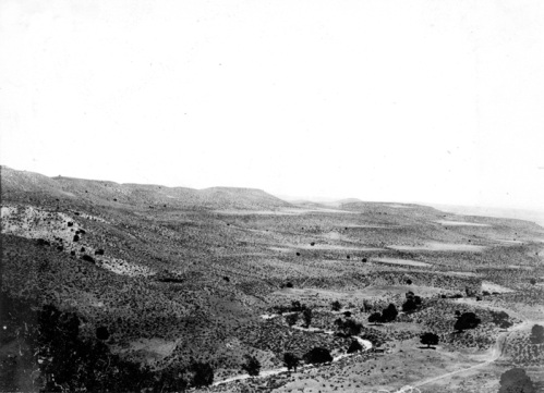
Stream terracesStream terraces are elevated portions of a floodplain created when the stream down cuts and creates a new floodplain at a lower elevation. Stream terraces are important indicators of environmental change. Down cutting can be initiated by uplift of the land surface due to tectonic activity, increased flow, or a loss of sediment load.
Figure 18.37 Stream terraces along Zapato creek, the upper terrace is an important one throughout the hills. Fresno County, California. 1907. USGS Historical photo. (Courtesy USGS) Deltas
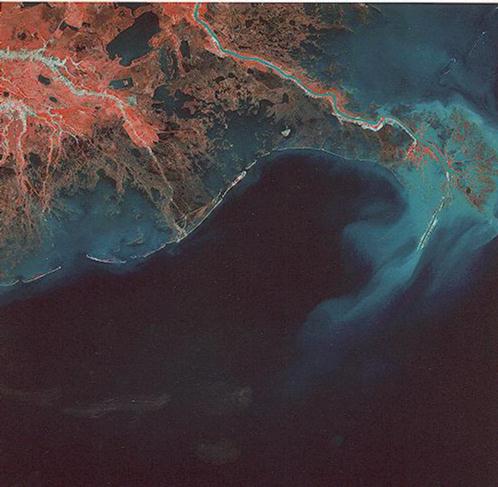
Figure 18. 38 Satellite image of the bird's foot delta
of the Mississippi River Deltas form by the deposition of sediment at the mouth of stream when water flows into a lake or the ocean. Stream velocity decreases upon entering the ocean which causes the stream to deposit its load. The shape of a delta depends on a number of factors like the rate of sediment supply, wave action and coastal currents reworking the deposited sediment, and the rate at which the alluvial deposits subsides. For more about deltas see: "Deltaic Landforms" Geomorphology From Space, NASA. |