Chapter Review
Assess your understanding of concepts related to this chapter by answering the questions below. Click the question to reveal the correct answer.
Shield volcanoes have broad, low-angled slopes and built layer on layer of fluid lava. Composite volcanoes are steep-sided cones built from alternating flows of lava and pyroclastics. Cinder cones are smaller cones built primarily from explosive eruptions of pyroclastics.
|
Shield Volcano |

Composite Volcano |

Cinder Cone |

In subduction zones, along the midocean ridge, and over hot spots.
Eruptions from shield volcanoes tend to be dominated by effusive eruptions of fluid lava. Composite volcanoes produces explosive eruptions from stickier magma.
Mudflows called lahars are caused by the rapid melting and runoff of snow mixing with ash and soil.
Hot ash, pumice, rock fragments and noxious gas that moves rapidly down the side of a volcano.
The most common gas released by magma is steam (H2O),
followed by CO2 (carbon dioxide), SO2 (sulfur
dioxide), (HCl) hydrogen chloride and other compounds.
By the volcano blowing the summit off or magma draining from the central vent removing support for the summit causing it to collapse in.
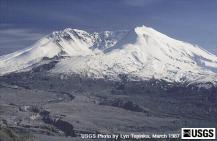
Mt. Saint Helens, Courtesy USGS
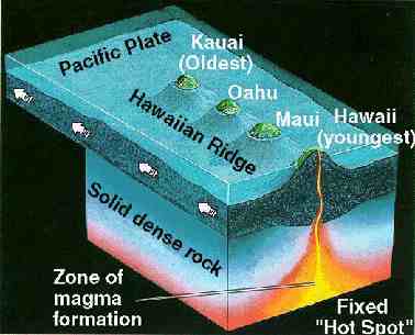
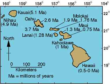
The Hawaiian islands were formed by volcanic activity over a hot spot. The youngest island in the chain lies toward the southeast as the Pacific Plate moves toward the northwest.
 Click image to enlarge |
 Click image to enlarge |
Hawaiian islands forming Source: USGS |
Age of Hawaiian Islands Source: USGS |
A flood basalt of 170,000 cubic kilometers known as the Columbia River basalts covered a large portion of southeastern Washington, eastern Oregon and southern Idaho creating the plateau.
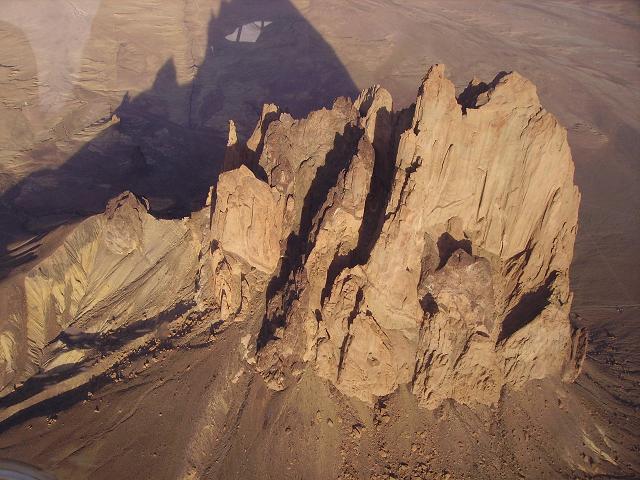
A volcanic neck is the "mold" of the central vent. Magma stuck in the central vent cools. Removal of the overlying rock exposes the plug-like shape within. Shiprock, NM (below) is a notable example of a volcanic neck.