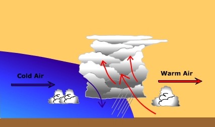
Cold Front WeatherWeather along an advancing cold front is much different than that along a warm front (Figure 8.19). Friction slows the advancing cold air causing a steep slope to the front. The steep slope pushes the air ahead of it rapidly upwards and vertically developed clouds (cumulus) are produced along the front. As with a warm front, you experience a drop in the atmospheric pressure as the front approaches. As the cold front passes you, the winds shift from south to southwest, and finally to a westerly direction.
Figure 8.19 Profile of Cold Front
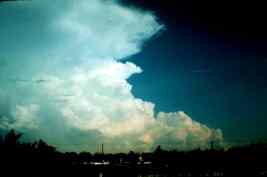
Figure 8.20 Towering cumulonimbus cloud With greatly contrasting air masses on either side of the front and potentially unstable conditions, violent weather can form. Towering cumulonimbus clouds are common along cold fronts producing intense downpours of rain lasting for a relatively short period of time. Tornadoes can form under the most extreme conditions ahead of an advancing cold front. Below is a table that briefly summarizes the weather conditions associated with wave cyclones and their associated fronts. Instead of reading from left to right, read the table from right to left. Doing so will give you the perspective of the system moving through your location with its center to the north along the transect identified in Figure 8.16. Click on the cloud abbreviations to get information about them. Table 8.1 Weather changes associated with passage of midlatitude cyclone
Cloud abbreviations:
Check your understanding of the preceeding material by "Looking Back: Wave Cyclones and Weather" or skip and continue reading |


