Tundra ClimateThe tundra climate is a transitional climate between the Subarctic and Ice cap climates. It is a region of rolling to nearly level terrain almost entirely devoid of trees. Polar climates like the tundra are characterized by very cold temperatures and generally dry conditions. Temperatures never rise above 10o C (50oF) during the summer. The tundra located near the Arctic and Antarctic Circle, experiences times when the Sun never rises above the horizon.
(Source: USGS Digital Data Series CD-ROM DDS-21 Used with permission)
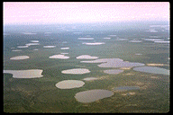
It is so cold in the tundra that permafrost is a prominent feature. Permafrost is soil, rock, or peat that has been frozen for more than two years. Near the surface the "active" layer thaws during the summertime and subsides or moves down slope. During the winter, the surface heaves as it refreezes. The alternating freeze-thaw cycles make it difficult to build structures on such a surface. More importantly, permafrost stores vast amounts of carbon in slowly decomposing organic matter. Disturbed by warming, greenhouse gases are released. For more about the role of permafrost in environmental change, try Digging Deeper: Permafrost and Climate Change or skip and continue reading. Geographic DistributionThe tundra climate is found as a nearly unbroken ribbon of land on the Arctic ocean border lands of North America and Eurasia, and along the margins of Greenland. Though nearly exclusive to the Northern Hemisphere, it can be found on peninsular land of Antarctica.
Controlling FactorsThe tundra climate is directly tied to its location in high latitudes. Here, the subsidence and divergence of the polar anticyclone is an important control over the climate. The subsidence associated with high pressure decreases the chances for precipitation. Located at such a high latitude creates low temperatures that reduces moisture content of the air. Arctic front cyclones bring moisture bearing winds to the tundra climate. Controlling Factors
TemperatureBeing a polar or high latitude climate, the tundra is noted for its low temperature. The tundra is basically summer-less, having no monthly temperature averaging above 10o C, and having at least nine months below freezing. These temperatures preclude the growth of trees. Even though temperature ranges are high, they aren't as large as the Subarctic climate to the south. The smaller temperature ranges are due to the moderating influence of the ocean. Diurnal temperature ranges tend to be small because of the uniformly high insolation during the summer and uniformly low insolation during the winter. The seasonal lag in temperature is delayed by a month for the tundra found in eastern North America and western Eurasia due to the influence of the ocean. Here the warmest month is August but it is July for the remaining tundra climate. Similarly the coldest month is also delayed until March for much of coastal western Siberia, though eastern Siberia experiences its coldest temperatures in February. PrecipitationThe very cold temperature creates absolute humidities that are lower than those found in the tropical desert. As a result, precipitation is characteristically light, usually less than 250 mm (10 in) a year. However, eastern and western reaches in North America and Eurasia have nearly double this amount due to the influence of the ocean. For instance, Nome, AK receives 18.4 inches a year while Point Barrow receives only 508 mm (4.3 in). Precipitation is concentrated in the summer months with July receiving the most precipitation for inland stations and August for most coastal stations. Some marine stations in Norway receive most of their precipitation during the winter months of February and March. Coastal locations are susceptible to fogs as maritime air drifts onshore and is chilled to its dew point by the cold land surface. |
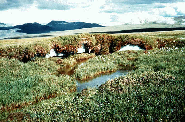 Figure 9. 36